
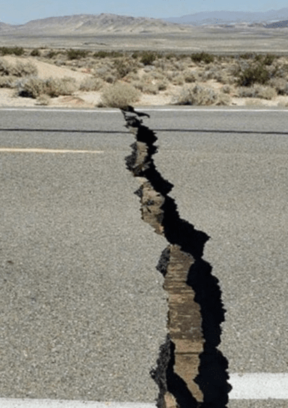
This month marked the one-year anniversary of the M7.1 Ridgecrest earthquake. Amateur radio operators can now report the effects of an earthquake, their experiences and the extent of the damage via radio using the “Did You Feel It” (DYFI) form on Winlink Express. This information is transmitted directly to the United States Geological Survey’s (USGS) “Did You Feel It?” system which creates community earthquake intensity maps. The form allows amateur radio operators to become citizen scientists who contribute to earthquake research and support earthquake education and preparedness in their area.
Here’s a presentation on DYFI Winlink from Oliver Dully-K6OLI at k6oli@arrl.net.
The Did You Feel It? (DYFI) system *was developed to tap the abundant information available about earthquakes from the people who experience them. By taking advantage of the vast number of internet users, and Winlink radio clients, scientists can get a more complete description of what people experienced, the effects of an earthquake, and the extent of damage.
By providing a DYFI report when you can do so safely after an earthquake hams contribute to citizen science and further the understanding of earthquakes. This is a two-way street: not only will you add valuable information on the extent of ground shaking and damage, but in the process we hope you will learn more about how other communities fared and gain a greater understanding of the effects of earthquakes.
The DYFI form is available in Standard Forms library under the USGS folder. To learn how to use the Winlink DYFI form, please visit https://youtu.be/OutjBBflVF8.
The USGS Did You Feel It? (DYFI) system collects macroseismic observations from the public in the minutes and hours after an earthquake. As an online questionnaire, it is potentially vulnerable to interruptions in power and internet connectivity after a damaging event, particularly in areas of very strong shaking. Using amateur radio transmission bands, Winlink DYFI can mitigate communication blackouts and fill in information gaps for the USGS in the hardest hit areas early on.
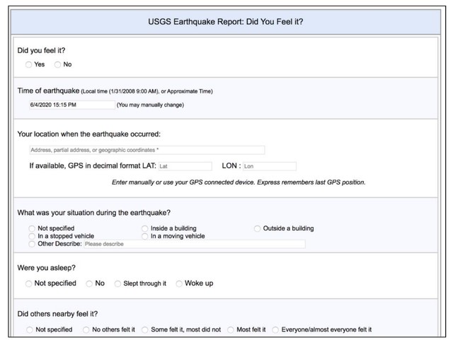
The Winlink DYFI form is modeled after the USGS DYFI online questionnaire and delivers data in the same format to the same USGS database. Working closely with USGS, the Winlink Development Team (WDT) and ARES LAX (Los Angeles County) developed a Winlink form that delivers a JSON file which can be ingested by the USGS database.
To test the new Winlink DYFI form, ARES LAX reached out to amateur radio groups in earthquake prone areas to engage beta testers and to develop training for users. Many groups from California (San Diego ARES, Ventura County ARES, Kern County ARES, San Joaquin Valley ARES, Sacramento Valley ARES), Washington (AAECT, MIRO, NBAT, PSEARES), Arizona (Yavapai County ARES/RACES), Hawaii (Hawaii ARES) and Mexico (CREBC) assisted and set up their own Winlink-based exercises and provided critical user-based feedback, which improved the robustness of the Winlink form and quality of the collected data.
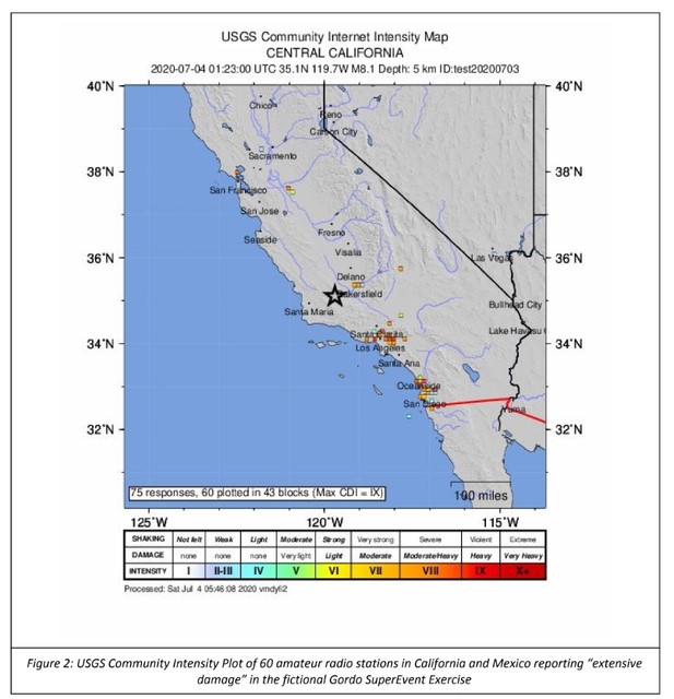
The cooperation between the USGS, the WDT and the amateur radio emergency groups mentioned above culminated in a recent exercise dubbed “the Gordo SuperEvent,” a fictional large earthquake that affected the entire west coast of the U.S. Seventy-five amateur radio stations from the contributing groups sent in DYFI reports via the 70cm, 2m, 20m, 40m and 80m bands during the exercise. Hawaiian stations even used the Winlink form to report a real event: around the time of the exercise an M4.3 earthquake occurred near Fern Forest, HI.
The DYFI on Winlink project demonstrates the successful interoperability between amateur radio operators and a USGS system. It also underscores how Winlink and amateur radio can offer additional flexibility and redundancy to data driven organizations in the event of communication blackouts.